20 Artists 20 Parks is a celebration of 100 years of the Iowa State Park system. It is a partnership between the Iowa Arts Council, College of Design at Iowa State University, Iowa Department of Natural Resources. Twenty artists participated in the creation of artworks based on twenty parks.
A deep map contains more information than the standard 2D visual map of a place. Besides names, topography, and distances, a deep map is a method that is often displayed in written form. Deep mapping provides information that includes history, personal experience, archaeology, ecology, folklore, natural history, science, weather, and storytelling over a course of time. The goal of a deep map is to provide the reader or viewer with an opportunity for greater, multi-layered knowledge of a place that is typically small and rural. This can be described as creating a sense of place, a spirit of place, or local distinctiveness. Others have described the process as an intensive exploration of place.
As a visual artist, through photography and printmaking, the method of deep mapping becomes an opportunity to explore the many types of information I can find or record about a place in a visual way. Inspirations for me include historical maps such as the historical Ebstorf and Hereford maps, the map of Rome by Giambattista Nolli, and the Piri Reis map as well as artworks of the A:shiwi (Zuni) counter-mappers. All of these examples incorporate several types of information through the geography, topography, recorded observations, drawings of humans and animals (also mythical creatures), notations, symbols, and text. Through this combination of information, the visual map becomes not just a representation of geography, but a narrative of the place that presents a chronicle of the history and meaning embedded there by myself and others.
For the Iowa DNR Parks 20/20 Celebration, I created a deep map of Wildcat Den State Park. Located near Muscatine, Iowa, Wildcat Den State Park holds a mix of natural beauty and historical features that were exciting to uncover and explore. The deep map form of the piece speaks to the various layers found in the place by pulling the layers apart and vertically elongating each layer on thin strings. The piece tells of the topography, geography, and flora and fauna as well as the many ways people have changed the meaning and value of the place over time. The various layers of the deep map are meant to be hung in space, so that the viewer can change the perspective as they move around the map.
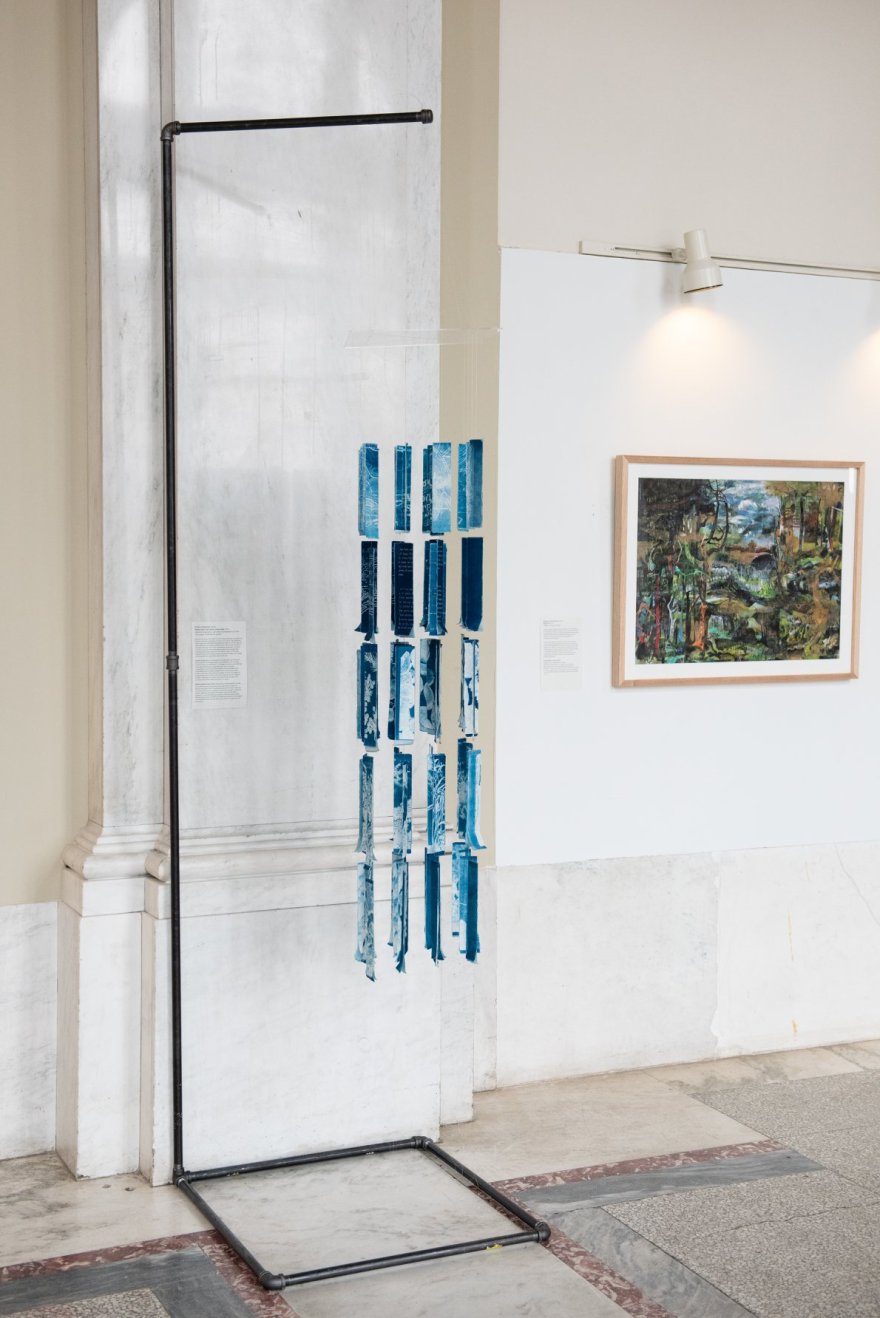
Digital photography, cyanotype photography on Thai Kozo paper mounted on acrylic
Photo by Jon Lemons Photography

Photo by Jon Lemons Photography
